Motivation
In 2019 I was making time to run, but I kept running the same routes and was in a bit of a running rut. My routine of Duke campus trails and Durham greenways became a little too routine. In Fall 2019, though I can’t recall exactly where or when, I first saw some purple-lined maps. It was likely some runner’s photos on Instagram or Twitter where I saw maps from the
CityStrides website and service. I joined the site and synced my GPS running data from Strava and Garmin, but I noticed Durham, NC wasn’t listed as a supported city. I asked a friend on Twitter to help me look into the problem, and we found that the city boundary shared on OpenStreetMap wasn’t properly defined; one of the annexed segments contained an unclosed polygon. After he closed the path, the CityStrides developer,
James Chevalier, added all the Durham streets to the CityStrides map in early November, 2019.
 |
 |
 |
|
2009 Raleigh Rocks Half Marathon, Garmin Forerunner 205
|
2018 Fullsteam Point 262, Forerunner 35
|
2021 EVERYSTREET DURHAM Final Run, Forerunner 245
|
I have used GPS tracking via Garmin watches off and on since 2009. So when my previous data showed up on CityStrides, I had already run thousands of miles in Durham, but I had covered far less of the city than I’d imagined:
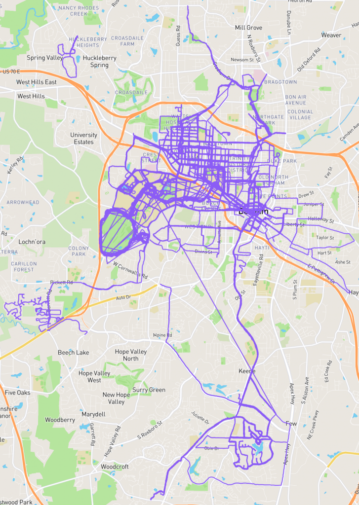
So with Durham now in the system, in late 2019, I was off and running with a goal of covering new streets every time I laced up. With an area of 112.6 mi², Durham is nearly three times the size of Paris, and running all the streets of Durham is a momentous task, but one that was fun for me to chip away at. Through later emails with city officials, I discovered that Durham City maintains 800 miles of city streets and NCDOT maintains another 200 miles of roads within Durham city limits. There are countless more miles of streets within apartment complexes and townhome neighborhoods included in the total of over 4250 roads. Only highways, private drives, gated communities, trails and greenways would be excluded from my quest.
Professional runner
Rickey Gates completed all the streets of San Francisco in 2017, and he noted “To walk across a place is to observe and participate in a vast, intricate and complex web of infrastructure. It is to experience the history of that place in a very real and personal way.” See his awesome video:
https://youtu.be/jy_W5qsjB5UCOVID-19
As I was just starting this challenge, the coronavirus, as we called it then, was spreading in China and then Washington state. In March, the pandemic started affecting our lives close to home. We pulled our daughter from full-time daycare for two months and tried to work from home at the same time. I mostly took a CityStrides hiatus for April and May, spening a lot of time with my daughter, going on bike rides, camping in our backyard, and finding other adventures. In June, she reentered daycare, while my spouse and I continued work from home. Without my daily bike commute to the office, I turned back to running to keep up my daily activity level. With the added flexibility of my schedule, I structured my week around running most mornings. With social distancing being encouraged, CityStrides allowed me to run new roads, while avoiding people crowding popular trails and greenways. As I was ramping up my miles, the hot summer months were setting in.
Blood Donations
I’ve been a regular blood donor for years, giving over 100 units across several agencies, primarily the Red Cross. I gave blood several times during the summer of 2020, to help people, as a response to a donor shortage, and out of curiosity for my COVID-19 antibody test results (thrice negative). In the past few years of blood donations, I have had some issues with low-iron anemia, and I even took a year off from making donations. I didn’t seem to be expecting any ill effects this time around, but I also hadn’t pushed my cardiovascular system this much.

A Supportive Running Community
Over the summer, I started following and cheering on other people running all the streets in their cities, connecting via the CityStrides web site message boards, Instagram, and Strava. I found that the runner just ahead of me on the Durham leaderboard was also an employee at Duke. Having someone to chase helped motivate me to increase my mileage in the Fall of 2020. From that time, until we both finished in Spring 2021, he stayed about 100-200 streets ahead of me, despite my increasing miles. In fall 2020, I reached out to journalists at Working@Duke with what he and I were doing to preserve our sanity and fitness during work from home.
Press Coverage, Recognition from Friends, and a Health Scare
When the
Working@Duke article was published online, people from the Duke community and on Social Media reached out with their support. The article ended up working as a commitment device, a public contract for me to uphold. Making my goal known in this way motivated me to do my best to finish the project. But shortly after publication, in late September, I collapsed suddenly and without warning in the middle of a run. It was a hot morning, and I was in a neighborhood with lots of cul-de-sacs, thankfully away from traffic. No one saw when I suddenly felt light-headed, knelt and laid down in the street. My GPS data later showed me I was down for 25 seconds while my heart rate decreased. I made it back to my car and home, and generally felt fine, but I knew I needed to get checked out before continuing my quest. I then had blood work, an EKG, cardiac ultrasound, cardiologist referral, MRI, and CT over several weeks. Thankfully all of the tests came back with no structural abnormalities, no arrhythmias, and clean arteries. Doctors weren’t able to pinpoint an exact cause, saying it was likely a combination of the recent blood donations, dehydration, too much caffeine or an exertional response. In between the imaging exams and doctor visits, before I was fully cleared, I turned first to walking, then to running with chaperones, to make sure I stayed upright.
A Renewed Joy of Running with Friends
It had been some time since I had run with friends before COVID when there were races and social runs. Through these runs with my chaperone pals, several of my existing friendships were strengthened. We had hours of social distance running and spent time I wouldn’t have otherwise. It was great to be able to talk about our families, kids, jobs, and current events in a year that was otherwise very isolating. After being given the full green light from my cardiologist, I got back at it, first slowly through the holidays and then in full force in early 2021. I didn’t stop running with friends, but I added more solo efforts in between.
 |
 |
|
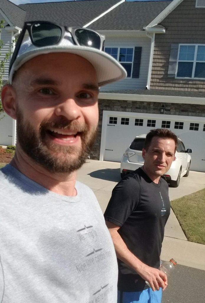
Running companions with two legs
|
and four
|
CityStrides for Physical and Mental Health
Structuring my week around runs, helped get me out of the house most mornings, which was key for my physical and mental health. During a work-from-home year, it was a boon to have a reason to get out of the house and neighborhood, to see some new streets and meet up with a friend. CityStrides also gave me a big, long-term goal to chip away at while seeing measurable progress. Each run, no matter how short, was chosen to contribute to the overall goal, and stats available after the run showed the number of streets just completed and a new completion percentage calculated. This measurement of progress toward my top-level goal helped to increase my grit and persistence. I am not new to big, hard projects. My PhD was another big hairy goal, but it had with fewer opportunities for measurable progress. There were some big milestones along the way, but often it was difficult to feel substantive progress in a single day. CityStrides, on the other hand, helped me tackle a city with 4253 streets in a gratifying way, with overt, measurable, daily progress. I came to enjoy “the Happiness of Pursuit”, to flip a well-known phrase.
Aside from the mental, social, and perhaps character-building benefits, I had real health benefits too. Counter to the national trend, I lost weight over the course of the pandemic, due to my increased exercise and somewhat decreased craft beer consumption. My resting heart rate went down to the 40s (BPM) overnight, and my watch says my VO2Max increased. Besides the collapse, I was probably in my best shape since my time living in Denmark.
Getting Around on Foot
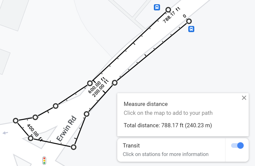
Around Durham I couldn’t help but notice the terrible conditions of sides of many roads: no shoulder, no sidewalk, overgrowth and weeds. Twice I even fell while running: once on an uneven sidewalk, skinning my palms and knee, and once into a divot/hole alongside a busy road. All over the city I noticed bare-bones bus stops and the lack of crosswalks or wheelchair ramps, especially in places where people were dependent on public transit. These deficiencies were most acutely observed in neighborhoods that really needed safe pedestrian and bus access. I’m convinced that rather than chasing the next big expensive shiny thing in mass transit, we need to spend real money to improve busing and walking conditions in the places that most rely on them.
White Male Runner Privilege
A few friends asked if I felt safe in some parts of town, and the truth is I felt comfortable almost all of the time. Sure there were neighborhoods I didn’t enjoy very much, but mostly because of the poor road running conditions or scary, loose dogs, not the people I encountered. Would a black runner, Hispanic runner, or female runner feel safe and welcome in many parts of town? Would they stop at the “no trespassing” and “private road” signs that I had to run past to finish some dead-end roads? I experienced no threats, saw no guns, and heard no angry shouts directed at me. No Karens called the cops on me. No aggressive notes were left on my car about my parking. I hope we as a society can get to a point where running isn’t just safe for white men, and it doesn’t get people like Ahmaud Arbery killed. I recently supported some charities that work with
girls and
black women via running, but I’m looking for other ways to be an ally and good neighbor.
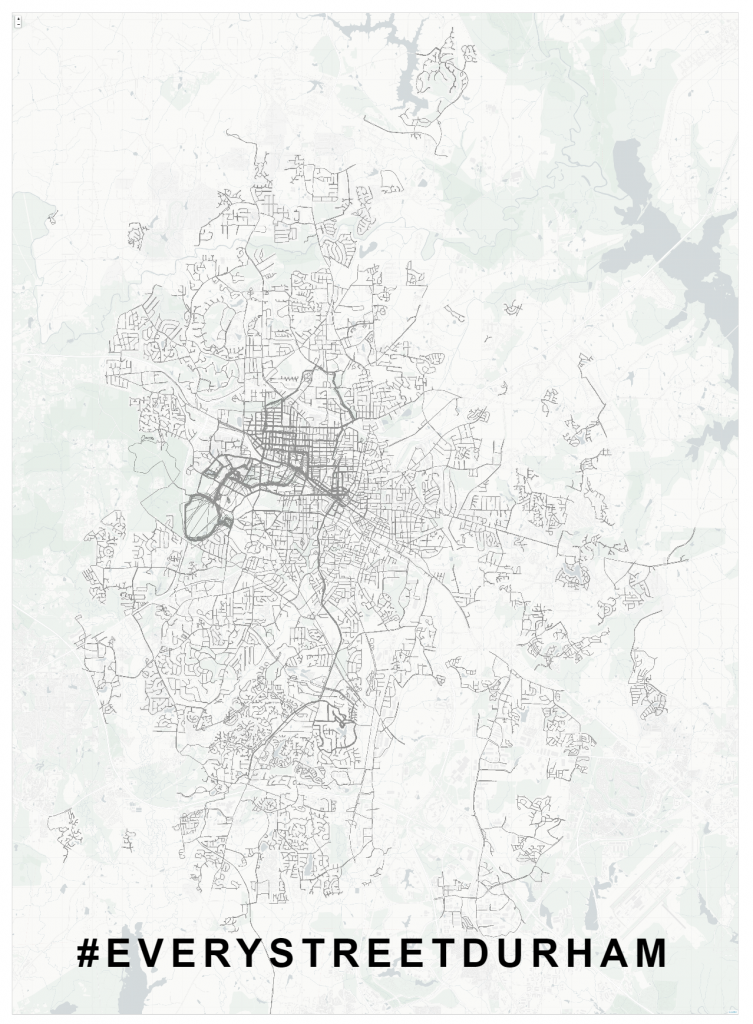
Finishing #EVERYSTREETDURHAM
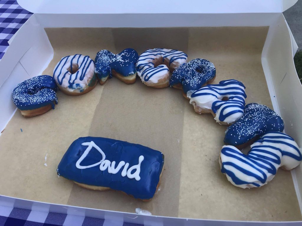
Nov 2019 to May 2021, I worked on running all the streets of Durham. On Saturday May 8th, I finished the map for the first time, until more roads were built! We celebrated with the final run and a socially distanced outdoor meetup of bagel, donuts, coffee, and mimosas. The 3.25 mile run began at the final street, Cassington Lane, traversed part of the Al Buehler trail, and climbed some hills on Anderson.
Tracking, Data, and Visualization Tools
Stats as of Finish:
- Since Nov 2019: 1865 mi, 385 runs
- Since 2008: 5364 mi, 1205 runs (much repeats)
Conclusion
As a long term goal and COVID sanity exercise, running all the streets of Durham provided many benefits to me. I hope that I will look back on the time of masks and stay-at-home orders and remember the snapshot of the city that I took using my feet and my eyes over the course of the project. I feel like I got to know my city and its people a bit better.
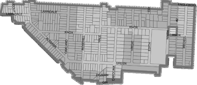
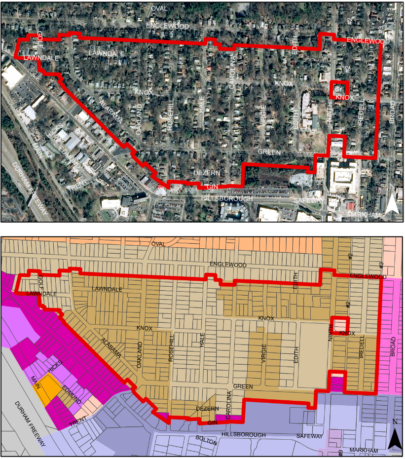
Try it on a Small Scale
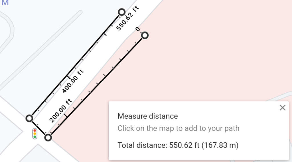
I’m launching a challenge for my neighbors and friends called #EVERYSTREETOLDWESTDURHAM. Below is a map of the city boundaries for Old West Durham, my neighborhood. It’s about 6 miles of roads, roughly bounded by Hillsborough, Englewood, and Broad. Try to run the included segments of the following streets, and post your photo with the hashtag above: Lawndale, Golf, Alabama, Knox, Oakland, Rosehill, Hale, Dezern, Gin, Carolina, Green, Virgie, Edith, Ninth, Alley #2, Englewood, and Iredell.